Pass Creek and Engineer Mountain 
Distance: 4.8 - 12.8 miles (round trip)
San Juan National Forest, near Silverton in Southwest Colorado
This scenic hike, travels through the high meadows to northwest of Coal Bank Pass, features terrific views of Engineer Mountain, Twin Sisters, the high peaks ringing the Cascade Valley and the summits rising to the south of Silverton.
See Trail Detail/Full Description
- Distance: 4.8 miles (round trip) to Engineer Mountain
12.8 miles (round trip) to Trail End - Elevation: 10,670-ft. at Trailhead
11,690-ft. at Engineer Mountain
12,210-ft. at Trail End - Elevation Gain: 1,020-ft. to Engineer Mountain
2,425-ft. to Trail End - Difficulty: strenuous
- More Hikes in:
Silverton / Southwest Colorado
Why Hike Pass Creek and Engineer Mountain
Combine the Pass Creek and Engineer Mountain trails to create a long, scenic hike through beautiful meadows with fine views of Engineer Mountain, Jura Knob, the high peaks along the Cascade Valley and the summits to the south of Silverton.
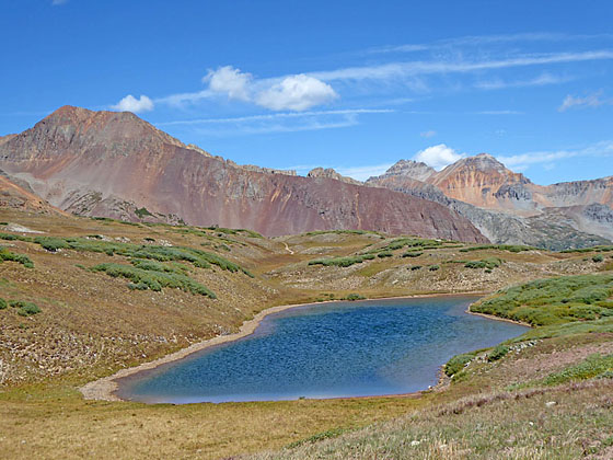
The hike ends near a pretty tarn high above the West Lime Creek Valley. Here Twin Sisters, Rolling Mountain, Beattie Peak, Fuller Peak and Vermillion Peak grace the skyline to the north/northwest. Jura Knob, Sultan and Grand Turk dominate the view to the east/southeast.
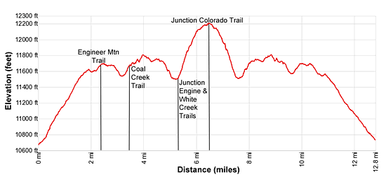
Over the course of this long hike the trail gains almost 2,500-ft. and loses over 900-ft. as it dips in and out of drainages and crossing the rolling terrain. The elevation gains along with the distance make this a strenuous hike.
Pick a beautiful day and get an early start so you can take you time traveling through this scenic area, enjoying the views both near and far. The initial Pass Creek trail segment will be busy with hikers seeking to climb Engineer Mountain. After 2.4 mile you will leave the crowds behind and encounter few hikers along the remainder of the trail.
Note: The Pass Creek and Engineer Mountain trails are open to bikes. Hike the trail on a weekday to avoid most of the bike traffic. Typically you will see few bikes on the Engineer Mountain section of the hike.
Elevation Profile

Buy the BookThis opinionated guide includes all the hikes in the Ouray, Telluride, Silverton and Lake City sections of the website plus info on local services and nearby attractions. | |
Trail Resources
Trail Detail/Full Description / Trail Photo Gallery / Trail Map
Basecamp(s) Information:
Silverton
Region Information:
Southwest Colorado
Other Hiking Regions in:
Colorado

